Trail Other activity Saint Geniez d'Olt et d'Aubrac - GR60 Du signal de Mailhebiau (Lozère-Aveyron) à l'Espérou (Gard) (2016) - Photo

GR60 Du signal de Mailhebiau (Lozère-Aveyron) à l'Espérou (Gard) (2016)

 leon40
leon40

User

© OpenStreetMap contributors
Length
Length
98 km
Max alt
Max alt
1543 m
Uphill gradient
Uphill gradient
2790 m
Km-Effort
Km-Effort  
135 km
Min alt
Min alt
465 m
Downhill gradient
Downhill gradient
2946 m
Boucle
Boucle
No
Creation date :
2018-04-16 12:35:43.081
Updated on :
2018-04-16 12:35:43.081

(0 Reviews)

Other activity
Other activity
--
Difficulty : Unknown

Scan this QR Code to open this trail in the SityTrail application

FREE GPS app for hiking

Logo SityTrail SityTrail

IGN / Geographical institutes

Download SityTrail from the App Store Download SityTrail from Google Play

Logo SityTrail SityTrail World

The world is yours!

Download SityTrail from the App Store Download SityTrail from Google Play Download SityTrail on Huawei AppGallery

About

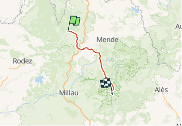
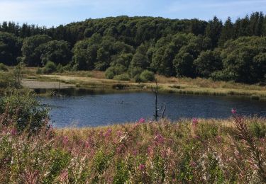
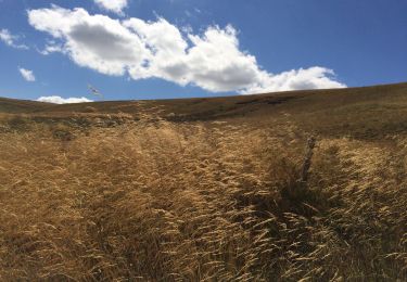
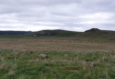
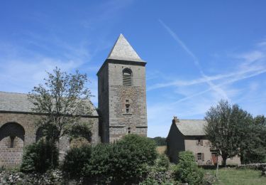
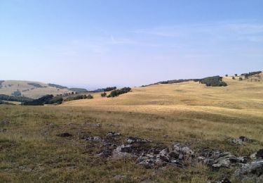
Trail Other activity of 98 km to be discovered at Occitania, Aveyron, Saint Geniez d'Olt et d'Aubrac. This trail is proposed by leon40.

Description

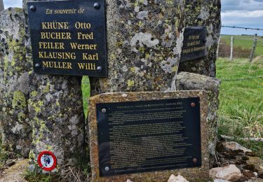
Randonnée avec le GR60 à travers la Lozère et le Gard du Signal de Mailhebiau à l'Espérou. Gîtes d'étapes, Chambres d'hôtes, Hôtels, Camping, Refuges, Auberges.

Elevation profile

Positioning

Country:
France
Region :
Occitania
Department/Province :
Aveyron
Municipality :
Saint Geniez d'Olt et d'Aubrac
Location:
Aurelle-Verlac
Start:(UTM)
505229 ; 4935915 (31T) N.

Trails nearby

Trail Walking Les Hermaux - Rando Lozère.. Rajas..Malailhebiai. - Photo
Walking
boubou68

Walking

Very difficult
Les Hermaux, Occitania, Lozère, France
20 km | 26 km-effort
4h 4min
Yes
Trail Walking Nasbinals - Montorzier Croix de Vaysse Croix de Rodes - Photo
Walking
GUIDE
antignacs

Walking

Easy
Nasbinals, Occitania, Lozère, France
15.4 km | 19.6 km-effort
4h 13min
Yes
Trail Nordic walking Prades-d'Aubrac - SityTrail - Sentier thématique de Brameloup - Photo
Nordic walking
mdauzat

Nordic walking

Very easy
(1)
Prades-d'Aubrac, Occitania, Aveyron, France
7.8 km | 10.5 km-effort
2h 0min
Yes
Trail Snowshoes Saint-Chély-d'Aubrac - Tourbière alte teste rodes  - Photo
Snowshoes
GUIDE
antignacs

Snowshoes

Easy
Saint-Chély-d'Aubrac, Occitania, Aveyron, France
9.9 km | 12.7 km-effort
Unknown
Yes
Trail Walking Nasbinals - Tourbiere salhens maillebiau rodes  - Photo
Walking
GUIDE
antignacs

Walking

Medium
Nasbinals, Occitania, Lozère, France
21 km | 26 km-effort
6h 14min
Yes
Trail Walking Les Salces - Autour de maillebiau bonnecombes rajas - Photo
Walking
GUIDE
antignacs

Walking

Medium
Les Salces, Occitania, Lozère, France
17.1 km | 22 km-effort
4h 23min
Yes
Trail Walking Marchastel - cap combattut  - Photo
Walking
yt34

Walking

Easy
Marchastel, Occitania, Lozère, France
7.2 km | 8.7 km-effort
2h 50min
No
Trail Walking Les Salces - Tour des Monts d'Aubrac - Du refuge des Rajas à Nasbinals - Photo
Walking
tracegps

Walking

Medium
Les Salces, Occitania, Lozère, France
22 km | 28 km-effort
5h 30min
No
Trail Walking Les Hermaux - Signal de Mailhebiau - Photo
Walking
gourdon

Walking

Medium
Les Hermaux, Occitania, Lozère, France
21 km | 27 km-effort
4h 45min
Yes


Close
My subscriptions